The winter
of 2014 was the roughest I’ve ever experienced. Spring had to wait an extra
month to arrive, or so it seemed to me. Yet, unlike the past years when I
needed a warm spring day to begin the kayaking season; that was not needed on
the Erie Canal. In the canal, kayaking is as easy as falling out of bed. My
plan was to begin season six on Thursday, May 1. But something occurred two
weeks earlier that made that starting day questionable.
I hit the
pavement headfirst. Thank goodness I was wearing a helmet or I might not be
able to write this now. Next, my rib cage went plowing into the handlebars and
(from x-rays) at least four ribs were broken. When lying on the ground
not moving, one of the things that went through my head was: would I be able to
runyak in two weeks?
The
following few days after the accident were maybe the worst in my life as far as
(non-self-induced - accidental) pain goes, but I was determined to head back to Clyde, NY come the first day of
May.
Two
days before I was to leave, friends were trying to talk me out of it, but on my
datebook there wasn't another four days clear for some weeks.
The wife also
tried to talk some sense into me. I again look at the calendar. The following
week was clear except Sunday was Mother’s Day. I’d never been away from home on
Mother’s Day, so that was not an option.
Hope and I
share grandparenting duties during the school week because of our daughters
teaching job. If Hope was willing to an extra day of solo grandparenting I’d
put off runyaking for another six days. She agreed and I stayed home and did
some more healing.
It is a
good thing I did. Because of spring flooding, the locks were not open until
8:00 am May 7. That's the same day I arrived.
Today,
after launching from where I left off last October at Clyde’s Lauraville
Landing,
I paddled two miles to Lock 26 and was the first boat through the
lock in 2014.
From Clyde
the canal takes a very southerly dip in geography into an area more remote than
anywhere on the canal previously. Because of this, the next landing was over 16
miles away by boat, and over 11 by foot. If I broke the paddle distance into
two days the run distance would be more than the paddle distance for lack of
roads.
I was not
sure I could paddle over 16 miles with broken ribs, so I decided to run last.
If I couldn’t make it, I could always find a way back somehow on foot. Also
plaguing me for a couple months was epicondylitis
(tennis elbow). In the end the tennis elbow bothered me more than the broken
ribs, at least when kayaking.
When
through Lock 26 I saw power lines passing over the canal. Upon utility poles on
both sides were huge birds nest. I first thought they were osprey nest but soon
saw a parenting great blue heron land in one.
The sightings could have been expected a few
miles ahead, for I was approaching Montezuma National Wildlife Refuge, but I
was still on the outreaches of the preserve.
Down canal a bit further I saw
another large nest. This time I saw bald eagles landing near it. It excited me
because it was the first eagle sightings of the expedition since 2011.
About
halfway into the 16-mile paddle I approached another lock: #25. I planned to
disembark before going through, have lunch, and assess whether paddling another
8 miles was physically possible. When approaching the lock I tried calling the
lockmaster to let him know I was near, which is custom, but I 'd programmed the wrong number in
my phone. So, I found a place where I could dock; then wandered around looking
for the lockmaster as I ate my lunch.
I never did
find him. Opening day of the year for the lock and the lockmaster not here? I
ultimately gave up the search and portaged Swiftee the 200 yards.
The lock
would have only lowered me six-feet; not like I really needed a lock to begin
with. At the lower level I began paddling again.
Since
leaving Clyde the canal does look different; more like a river. Well, it is a
river. The latest of the canal improvements of the early 20th
Century took better advantage of the nearby rivers. Causes of the change: barges
being larger, wider, motorized; not drawn by mules (my supposition). Where I’m paddling is
or once was called the Clyde River. Well after a mile of paddling from Lock 25,
I found where the longer Erie Canal and the shorter Cayuga-Seneca Canal (which takes advantage
of the Seneca River) meet.
As I progress to Albany I will pass more of these
shorter canals of the New York State Canalway System. Had I turned and followed
the other canal it would’ve taken me to New York's Finger (Cayuga & Seneca)
Lakes.
From this
junction the canal now takes advantage of the Seneca River. The Old Erie Canal
was much straighter, the newer river version sees much more meandering.
The boat
launch where I debarked today was quite muddy from recent flooding; so when out
of the kayak, I was slipping and sliding every which way. No longer is there a
trail to the decked launch, just grass, which was very soggy. There was a
nearby bridge (Howland Island Road bridge) but it was closed, so the area was
very remote. Until the bridge closed I'm guessing it hadn't been.
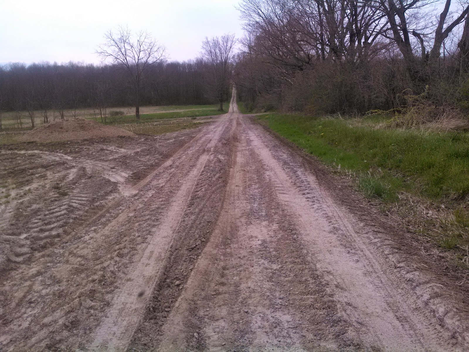
Montezuma
National Wildlife Refuge was to the south, but where I landed is NY state’s
Northern Montezuma Wildlife Management Area. I would have almost a three-mile
run on a hilly, sometimes rutted, clay, closed road to get to the exit of the
area.
The entire
run back to Clyde was 11.5 miles. Still suffering from broken ribs of 21 day
ago, I thought the run would never end. The ribs were the source of the pain but
it caused a backache that was close to intolerable by the time I finished.
Day 72 – 11.5 run, 16.1 yaked
=======================================================================
Runyak for Liberty, Day 73, May 8, 2014
When returning the next morning about 8:00 am I parked on the
opposite side of the canal where Swiftee was hidden. The Howland Island Rd.
bridge was barricaded but pedestrians could enter the game area by walking over
it.
At least four vehicle besides mine were parked at the dead end road. I
looked around for fishermen but didn't see a one, hmmm. Just before launching a young
lad with a shotgun passed by and said "Hi."
Ah, it's turkey hunting season, that's why all the
vehicles.
Just a mile into the paddle
I again spotted a bald eagle. The kind of thing I love seeing, accompanied with
a feeling of solitude.
With it being the second day the locks were open, I only
saw one boat on the canal, or Seneca River, whatever I decide to call it.
Seems all the landings and
launches noted on the Canalway Water Trail Map are not fitting my runyaking
distances. So, I ended the paddle at a large restaurant on the canal that did
not have a canoe landing or launch. I'd only found Delvaney's Riverside Grill
by using satellite images on Google Earth. From images I could see a landing,
but when I arrived it was too high up for Swiftee. I carefully exited from the
bank and prepared for the afternoon run.
I ate at Delvaney's before
the run and asked for permission to leave Swiftee on the bank cabled to a tree.
It was still quite early in the afternoon when the kayak and I parted. I wouldn't
see him again until morning. It probably was the longest I'd ever left him
unattended.
After the run back to the
van I drove some distance to Syracuse, NY where I spent the evening and even slept
in a parking lot of Armory Square, the city's nightlife district. I was awakened
more than once in the night by heavy rains and thunder. I lost much sleep
thinking about Swiftee… and how wet the next day’s runyaking might be.
Day 73 – 7.0 run, 6.4
yaked
=======================================================================
Runyak for Liberty, Day 74, May 9, 2014
When I awoke at 5:30
am the rain had stopped. From the parking lot I walked back through Armory
Square. Hours before it was bustling with people. Now it was empty and the
street now glowed in the dawns light, pavement still wet from the all night
rain. I was the only person left from the night before.
I headed for a Starbucks,
which did not open until 6:00 am, another ten minutes. When seeing a woman
carrying flowers in, I followed behind her, for I was chilled and wanted to get
out of the breezy morning air. She immediately read the riot act to me.
Starbuck Corporate policy says only employees can be in the store when not open
for business. With my tail tucked between my legs I walked back out. Next to
the Starbucks I passed time watching a 24-second shot clock tick down over
twenty times. The clock is a monument to the “
rule that saved basketball.”
The rule was first devised and used in Syracuse in the 1950s.
Finally, I was able to get
the Café Americano I'd wanted and get out of Syracuse and back to Delvaney’s to
be reunited with Swiftee. He was quite drenched from last nights deluge. I had
to stand him on end to get all the water out. The jacket I’d planned to wear
was hanging from a pole and drenched. But at least it wasn’t presently raining.
I might stay dry while paddling.
After draining Swiftee I looked around for an external phone battery, that I’d forgotten the day before. After many minutes searching and getting upset I finally gave up. I was about to launch, when there it was sitting on a stump. Finding it made me a much happier paddler.
With less than two miles of
paddling I could see the I-90 New York Thruway on my starboard side. The Erie
Canal runs from Buffalo to Albany and the toll road does basically the same but
rarely this close. This is the first location going east where motorized
vehicles and water vessels can view each other.
Being from Michigan I
dislike tollways and especially find the tolls of this particular turnpike
expensive. Before
Runyak to Liberty began, when I crossing New York
state, the tolls irritated me.
I now know that the New
York Canalways are subsidized by the tolls of New York Thruway. When I get
lowered through locks
for free I thank the system and I’m sure the lockmasters
have similar feelings for their jobs.
For the third day in row I
saw a bald eagle. Can't get any luckier than that, or do I have an eagle-eye.
Does it have something to do with the canal being a river? Hope so, for the
canal incorporates rivers for much of the distance from here to Albany. This makes
the eighth day of the thus 74-days of the expedition, I've spotted one or
more eagles while paddling: three times on the Flint River the first year, twice the
third year on Lake Erie, then the past three days of my sixth year.
At the five-mile mark of today's
paddle the "canal" crosses Cross Lake. Beforehand, I wondered if I'd
have to follow the shoreline, or make a direct crossing to where the canal
exited the lake. I'd save .75-mile if traversing the shorter way. It would all
depend on whether the weather was windy. As it turned out the lake was calm and
I bee-lined it across Cross.
Before the crossing I'd
been in communication with Hope back home. She seems to worry constantly about
me making bad choices. Today I was able to ease her mind with my smart phone;
taking a photo of the lake's calmness then sending it directly to her phone.
It's amazing the
technological changes just since I began exploring by kayak in 2005. When I
began, I was using underwater disposable cameras. I also printed maps and sealed
them in waterproof bags. My water/shock-proof-military-grade smart phone has eliminated both. Today with
gps locating I know exactly where I am on the map. And so does Hope back in
Michigan. As long as she sees my blip moving on the map she's not worrying.
Not far after the Cross
Lake, Seneca River dips south for a mile, then loops back north again. A
channel was cut to make it shorter. Had I followed the channel - the true Erie Canal - I'd have
saved two miles of paddling. But if I had, it would have created a bigger problem,
for the next landing/launch would have made the run possibly 15 or 20 miles.
So, I followed the Seneca River to the bottom of its loop. There I had options
of a launch or landings at Jack's Reef, NY, a settlement of small cottages on
the river.
I chose a floating dock belonging to Trapper's Bar. The owner there
gave me permission to leave Swiftee overnight.
The run back to Delvaney’s
was nearly ten miles. There was a stretch of Canalway Trail System I took
advantage of, although it did not follow the canal I'm paddling. It was part of
the 36-mile “Old Erie Canal State Park Trail.” It takes advantage of the
towpath of the Old Erie Canal. While running I stopped and took photos of Jordan Lock or Lock 51 that been out of use for a hundred years.
The run was exhausting
because of the heat and the crash injuries of 22 days earlier. At times I was
running 17 minute pace. I seriously could have walked faster but
that would
be against the rules! With a mile still to go I exited the trail by a party
store, where I bought a large Coke for some hydration to finish.
Water might have been a better choice but I have a problem paying money for bottled water. I come from a time people would have laughed at the very thought of buying bottled water. I still can't wrap my head around the idea.
After three days of
runyaking and sleeping in the van I was ready for a hot shower and a real bed.
I drove back to Syracuse, now only a dozen mile away, looking for a motel.
After several inquiries I found nothing available unless I was ready to fork
out $140 or more. It was University of Syracuse graduation week and hoteliers
had jacked up prices to gouge the graduate's family and friends.
El Cheapo runyaker found a
Pilot Travel Center, shelled out $12 for a hot shower and slept in the parking
lot with the rest of the truckers.
Day 74 – 9.75 run, 8.9 yaked
======================================================================
Runyak for Liberty, Day 75, May 10, 2013
Rainstorms again
woke me up in the wee hours of the night. After the final awakening I drove to where I would
end my May runyaking trip, Community Park of Baldwinsville, NY. After three
days consecutive days of kayaking first, and running last, I decided to go back
to my usual routine, run first, kayak last. Thoughts of repeating yesterday’s
hot afternoon run was what sealed the decision.
It was less than 9 miles,
and because of my freshly recharged body from last nights sleep with the
truckers, it was the easiest of the four days of running even though I’d run 30
miles the first three days. My mood while running was better, I even stopped
and took photos of flowers along the way.
I am getting closer to the
Adirondack Mountains and I felt it today; the miles were hillier than the
previous day's runs.
About halfway into the run
I came upon a crossroad named West Sorrell Hill. I panicked. The last road I
crossed was Sorrell Hill. Was I going the wrong way? I had stopped a half-mile
back to take photos. I must have taken off afterwards in the wrong direction?
But the corner didn’t look familiar, so I pulled out the smartphone and looked
at my location. On the map I saw that there were two Sorrell Hill roads, the
last intersection I’d past was East Sorrell Hill Rd. I was relieved thanks to a
gps and smartphone. Years before I might have ran extra miles to find out I was
wrong to begin with.
When arriving on foot back
at Trapper's bar and before launching, I again had to drain Swiftee from last
night’s rain even though the cockpit was mostly covered with a spray skirt.
While in route on the
Seneca River/Erie canal I kept an “eagle” eye out, trying to make it four days
in a row, but the three-day streak ended.
In downtown Baldwinsville,
and a mile from the launch where I’d land, was Lock 24, the twelfth lock I
passed through (or portage by). I’m now feeling like a seasoned boatman
navigating through them. To the point I don’t need to acknowledge gawking spectators
watching locking procedures. Yet I did wave to a young couple as I exit and
paddle onward.
I was now 199-feet lower than when I started the canal back in
Buffalo.
It was a mere fifteen minutes later that Swiftee scraped bottom and landed
at the boat launch at Community Park.
Before I left for this trip I wondered if what I
was about to do (four days and eighty miles of runyaking) was very smart
considering my physical condition. While packing to go home I acknowledged it
had been a success; I was glad I’d done it.
Day 75 – 8.5 run, ,
10.2 yaked
======================================================================
Four day total - 41.5 run 41.4yaked
Map
of 1733 miles runyaked


 Bridge downtown B'ville

 I’ve
previously stated that some Flint River water finds its way into the Erie Canal
and to thus to Hudson and Atlantic. Something occurred today that made me
doubtful of that... Two miles north of the loop the Seneca River ended. Two
rivers met the Seneca, the Oneida and the Oswego. Had I followed the Oswego I’d
eventually end up in Lake Ontario. So, I veered into the Oneida River and
suddenly it felt as if I was paddling upstream. It became obvious that any
Flint River water was heading to Lake Ontario via the Oswego River.
I’ve
previously stated that some Flint River water finds its way into the Erie Canal
and to thus to Hudson and Atlantic. Something occurred today that made me
doubtful of that... Two miles north of the loop the Seneca River ended. Two
rivers met the Seneca, the Oneida and the Oswego. Had I followed the Oswego I’d
eventually end up in Lake Ontario. So, I veered into the Oneida River and
suddenly it felt as if I was paddling upstream. It became obvious that any
Flint River water was heading to Lake Ontario via the Oswego River.